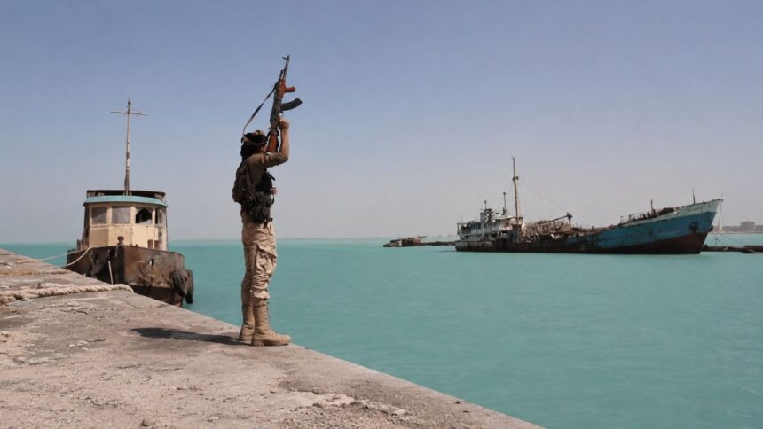
The Houthi rebels in Yemen have become active again in the Southern Red Sea, according to Reuters. Since August 15, insurers have expanded the high-risk area around the Bab el-Mandeb Strait, while Yemen’s internationally recognized government has announced more than 100 military operations against Houthi-controlled provinces, as reported by Al Jazeera. Yet the Houthis do not have a conventional navy. So how do they manage to disrupt maritime traffic in one of the world’s most strategically important chokepoints? This is not a case of traditional sea control. It is a clear example of sea denial.
Their strategy makes little sense without distinguishing between these two approaches to naval warfare. Their regional enemy, Saudi Arabia, uses a strategy of sea control to not just use the Red Sea for commercial purposes, but to dominate it through military naval superiority, complex alliances and heavy infrastructure. On the other hand, the rebels don’t need to fully control it, they just need to target strategic pressure points, to convey the feeling of uncertainty for all the ships that cross their waters, in order to project instability in the entire region.
The Houthi campaign demonstrates precisely how geography, instability and asymmetric capabilities can overshadow conventional naval superiority, and how a non-state actor can leverage these factors to deny access to any regional or global hegemon.
What does “sea denial without a navy” actually mean?
The Houthi campaign can be understood as a modern application of sea denial, adapted to the resources of a non-state actor that operates in a geographic environment that is extremely restrictive. Thus, we see how they use the rugged coast or the caves in the mountains close to the shore to launch a $20.000 smuggled Shahed across the Bab el-Mandeb, forcing Western destroyers to disproportionally retaliate with a million pound missile; not fully asserting their dominance in the waters, but creating asymmetric threats that force military or commercial vessels to think twice before passing near the Yemeni coast.

This context proves to be even more disadvantageous if we take into consideration the swarming tactics that the Houthis are known for. For instance, experts at the Center for Maritime Strategy use as an example a Type 45 Destroyer that has 48 vertical launch silos. In a saturation attack scenario, the type that is usually used by the Houthis, a destroyer may expend its entire primary stocks in minutes, thus, unlike conventional naval powers, which depend on costly fleets and the continuous control of maritime spaces, Houthi rebels employ tactical asymmetry to contest the access of technologically superior forces.
This seems to give them the upper hand, but this strategy is not possible everywhere. It depends on a particular combination of geography, political fragmentation and military capability.
The geography that makes denial possible
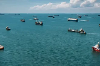
This crucial bottleneck represents a critical connection point between the Red Sea and the Gulf of Aden. From a geometrical point of view, the area functions as a “funnel” that compresses the maritime traffic and forces ships to pass a significantly limited corridor. By analyzing this data, we can draw the conclusion that the geometry of the Bab el-Mandeb effectively functions as an asymmetrical balancing factor between the states with interest in the region. While great powers like the US and China invest billions in aircraft carriers and high-end destroyers, they are simultaneously constrained by the dimensions of the strait and forced to maneuver in such a narrow space that the reaction time of radar defense systems is reduced to a minimum.
Systemically speaking, it cancels the strategic distances that vessels have in an open ocean, where a fleet can detect a threat from hundreds of kilometers. In this “funnel’’, the Yemeni coastline becomes a particularly advantageous launching platform for a drone or a missile that, if launched from a concealed location on the eastern shore, can target ships that cannot deviate from their normal course due to the depth of the water.
In this case, topography acts as an asymmetric shield for the rebels. If we compare the low and flat coast of its African neighbor, where most of the foreign military bases are located, Djibouti has a considerable disadvantage. But if we turn our attention across the sea, we can observe the rugged terrain of Yemen’s shore, which provides the perfect platform for launching attacks on the ships crammed in the channels and gives the rebels the chance to take advantage of their elevated tactical position. The highlands allow the rebels to deploy radar systems and even rocket launchers in places that are very difficult to detect, which essentially makes them considerably harder to detect and neutralize, granting them efficient striking capabilities that challenge the great naval powers of the region. The height of the mountains does not only serve as a hiding spot, but also as a control point, the line of visibility across the strait is considerably larger and a radar placed on one of the peaks at hundreds of meters of altitude can be more efficient than one positioned directly on a ship. The high mountainous chain and the rugged terrain allow the rebels to use guerrilla warfare and hit-and-run tactics by providing cover for mobile platforms that can easily retreat in caves or the deep Yemeni valleys.
The power vacuum on the shore
The political reality of contemporary Yemen is defined by a dual administrative authority divide that profoundly fractures the state into two different halves: the northern side, where the Houthis control the region from the capital Sana’a and the south, where the Saudi-backed government tries to rule, fight back and retake control from the interim center of power in Aden. According to Al Jazeera, on the 18th of August, the internationally recognized government has announced that its forces have conducted more than 100 military operations against the rebels, further escalating the hostilities between the two factions.
The territorial fragmentation of Yemen is even more acute when we take into consideration its shores and territorial waters, where control over different ports and naval infrastructures has become the stake in the fight between the two conflicting regimes. The strategic port of Hodeidah functions under Houthi authority and represents not just a hub for humanitarian aid, but is also a platform for power projection in the southern basin of the Red Sea, in direct opposition to the Aden port in the south of Yemen, that is controlled by the Internationally Recognized Government.
The fragmentation of the state has severely weakened Yemen’s maritime security institutions, including the Yemeni Coast Guard (YCG) that has been under institutional reconstruction for over 10 years, leaving the territorial waters under a sovereignty vacuum that prevents effective monitoring.
How a non-state actor builds sea denial
The military evolution of the insurgency movement is more than just a simple accumulation of weapons; it represents the process of assimilating the Iranian doctrine of asymmetric war and to apply it in the Red Sea theater.
According to a UN expert, the Yemeni militias were transformed into a feared armed force in the region by the Iranian Revolutionary Guard’s elite Quds Force, Hezbollah and Iraqi specialists and technicians, all members of the Axis of Resistance, which enabled the transformation of a guerrilla militia into a unitary force capable of operating complex weaponry systems. The presence of military advisers and technicians allows the transfer of know-how is a sign of substantial Iranian involvement, that has offered the rebels the capacity to adapt the Iranian military technology to Yemen’s geography and test it in real combat situations, and has provided training for soldiers to improve their asymmetric fighting strategies and to handle missiles or other sophisticated types of systems.
On top of that, facing international blockades and sanctions, the Houthis have implemented a modular supply chain based on the smuggling of high-tech critical components hidden in civil transports that are later assembled in underground facilities, as detailed by a report of The Century Foundation. Being able to produce arms locally, based on Iranian designs, provides the group with strategic resilience, making the destruction of its weapons deposits extremely difficult for aerial bombing campaigns.
It’s precisely the combination of external technology transfer, local manufacturing adaptation and geographic advantage that gives a relatively small rebel movement the ability to actually deny access through the Bab el-Mandeb or force commercial ships to use pricier routes just to avoid any risks.
From attacking ships to changing their behavior
The Houthis also use informational warfare as a power multiplier, documenting every attack and posting on social media to maximize the psychological impact, with only one purpose: to influence global maritime insurance markets, forcing major shipping companies to opt for far more costly alternative routes. Reuters reports that this shift is already underway following last month’s Houthi attacks. Apart from that, the main strategy is to gain the public international leverage that they need to obtain political recognition in Yemen or leverage over the Gaza conflict.
In parallel to this, we can observe a reduction in the total coverage offered by insurance companies. Since the Red Sea has been designated as a listed area that poses a high level of risk, this causes insurers to apply extra premiums or even introduce specific exclusions for cargo ships related to the United States, the United Kingdom or Israel. Recently, following a notice from its reinsurers, the Japan P&I Club announced that it is expanding its designated war-risk exclusion zone within the area of the Indian Ocean, Gulf of Aden and Southern Red Sea for specific policies, effective August 15, 2026 – meaning that an even larger area will now be subjected to higher insurance prices.
If ships change their behavior because of the threat, the attacker has achieved a form of maritime denial without controlling the maritime space.
The strategic implication
The broader geopolitical implication of the present conflict and a fact that is going to alter in the long term the security architecture of the region is ultimately the growing challenge to the practical exercise of freedom of navigation.
Since the conflict began, control over parts of the region’s maritime space has increasingly been contested by competing factions, creating an environment in which different actors can disrupt or restrict access to key waterways. Iran has actively pursued this strategy in both the Hormuz Strait and the Bab el-Mandeb, choosing to disrupt the transit without officially closing the strait until now, and in this framework commercial ships, including neutral ones, are subject to a selective policy which allows limited passage only for vessels with links to states considered partners.
The Houthis do not need to control the Red Sea to exercise power over it. In an increasingly contested maritime environment, making the sea difficult to use can be a form of power in its own right.
Read also
Atlas News Romania Accredited for the 77th International Astronautical Congress — Antalya 2026